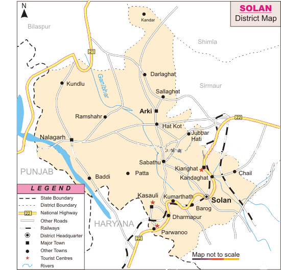
Created in September 1972, Solan District of Himachal Pradesh occupies an area of 1936 sq. km. Extending from 76.42 and 77.20 degree east longitude and 30.05 and 31.15 degree north latitudes, Solan District is nestled on the lap of the Shivalik Ranges. The district is bounded by Shimla district in the North and by Ropar District of Punjab and Ambala district of Harayana in the south and by Sirmaur and Bilaspur District of Himachal Pradesh in the east and west, respectively.
Solan District has marked a total population of 5,00,557. The local inhabitants depend on agriculture for their subsistence and adopt several traditional practices conducive for farming in sloping terrains.
Solan with its sprawling brewery, horticulture and forest universities and pleasant climate has an opulent array of magnificent tourist spots. Tourists can choose from a platter of exotic locales ranging from Kasauli, Barog, Chail, Parwanoo, Kiaighat and Darlaghat, respectively.
-----------------
Himachal_pradesh_district
bilaspur chamba hamirpur
himachal_pradesh kangra kinnaur
kullu lahulandspiti mandi-map
shimla-map sirmaur-map solan-map
una-map
--------------------
